Image:FS2018f5.14.jpg
From The Space Library
Size of this preview: 800 × 549 pixels
Full resolution (1,800 × 1,235 pixel, file size: 1.04 MB, MIME type: image/jpeg)
ISU (Talk | contribs)
(The Farthest Shore (electronic edition) - This diagram shows the solar wind compressing the Earth’s magnetic field, and confining it within the magnetosphere. Here the arrows indicate the direction of the Earth’s magnetic field. The outer boundary of )
Newer edit →
Current revision
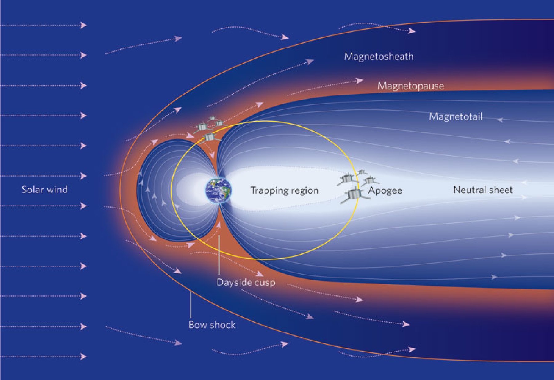
The Farthest Shore (electronic edition) - This diagram shows the solar wind compressing the Earth’s magnetic field, and confining it within the magnetosphere. Here the arrows indicate the direction of the Earth’s magnetic field. The outer boundary of the magnetosphere is the magnetopause (shown in pink, at a geocentric distance of ~ 6.5 Ron the dayside of the Earth, here). Solar wind plasma can enter the magnetosphere at the northern and southern cusps. The elliptical orbits of the four closely spaced spacecraft of the ESA Cluster mission are shown as the yellow orbit. For clarity the apogee is shown at a geocentric distance of 11 Rwhereas, in reality, it is at 19 R(from Goldstein 2003). (Courtesy of http://www.nature.com/nature/journal/v436/n7052/images/436782a-fl.2.jpg).
File history
Click on a date/time to view the file as it appeared at that time.
| Date/Time | Dimensions | User | Comment | |
|---|---|---|---|---|
| current | 17:44, 28 May 2018 | 1,800×1,235 (1.04 MB) | ISU (Talk | contribs) | (The Farthest Shore (electronic edition) - This diagram shows the solar wind compressing the Earth’s magnetic field, and confining it within the magnetosphere. Here the arrows indicate the direction of the Earth’s magnetic field. The outer boundary of ) |
- Search for duplicate files
- Edit this file using an external application
See the setup instructions for more information.
Links
The following page links to this file:
